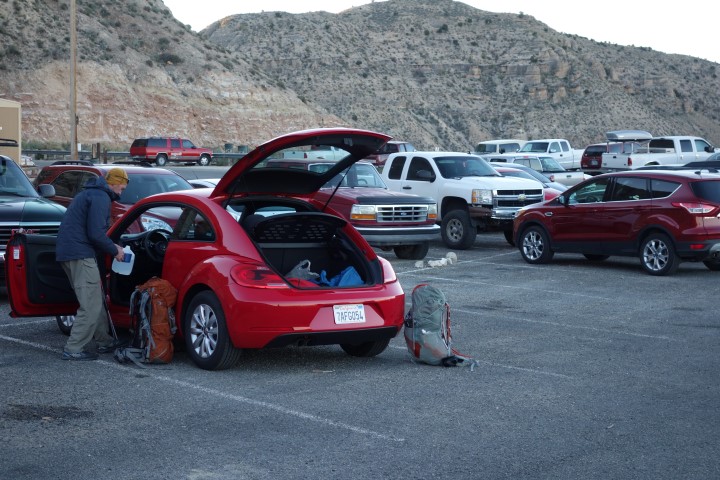
We were on the road very early from Seligman and saw the sunrise as we made our way to the Hualapai Hilltop parking lot. The plan when flying into Flagstaff the night before had been to either drive to the lot and camp there, although we were unsure of whether it was allowed, or to drive most of the way down Indian Road 18 and camp somewhere on the Bureau of Land Management (BLM) land before reservation land started. We received a terrible rental car though, a bright red Volkswagon Beetle with very little clearance, and had heard conflicting reports of what condition the road was in, so did not want to try to navigate it late at night when we were already tired from traveling all day. We grabbed a room in Seligman instead but the road turned out to be perfectly fine, paved the whole way and with only a couple of potholes.
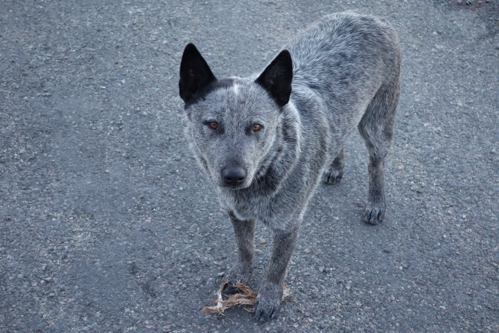
When we arrived at Hualapai Hilltop, we saw that some people had camped there and it appeared to be fine. Stray dogs were hanging out and there was a very strong smell of mule manure though, from the mule trains that carry baggage, tourists, and supplies down to the village. Elevation was at 5200′ and it was chilly. As we made our way into Havasu Canyon, I kept all my layers on as the sun would not make it into the canyon for several hours.
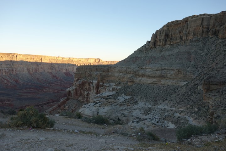
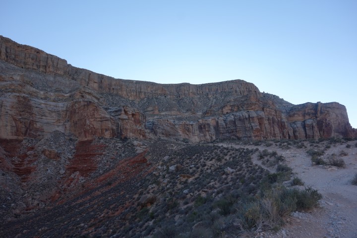
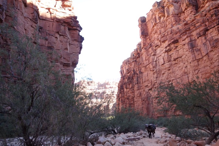
The trail started out going down on pretty steep switchbacks. We were early enough that no mule trains were going by but they have the right of way. Hikers need to get as close to the wall side of the trail as possible when mules are passing to avoid being knocked off the cliff side of the trail. There were only a couple of other hikers out there besides Greg and me though. After about a mile of steep trail, a lot of which was loose rock (I slipped on it and fell about thirty seconds into the hike), we had gone the majority of the elevation change down and would continue at a very shallow grade the rest of the way to the village.
We did start seeing mule trains making their way up past us after a few miles. The noise of them echoed through the canyon ahead of time so we knew they were coming. There were signs all over advising people not to wear headphones though and get caught off guard and possibly knocked over.

The path was wide and easy, going back and forth between rocks, sand, and gravel. There was even some water, although I doubt that it is there in summer. It was 7.5 miles to the tourist office in the village of Supai (elevation 3250′), where we checked in and got the necessary permits. I had called ahead of time to make a reservation since if you just show up without one, you pay double. I signed a form promising not to climb on the canyon walls, dive from the waterfalls, or hold the tribe liable for any injury, and we were on our way.
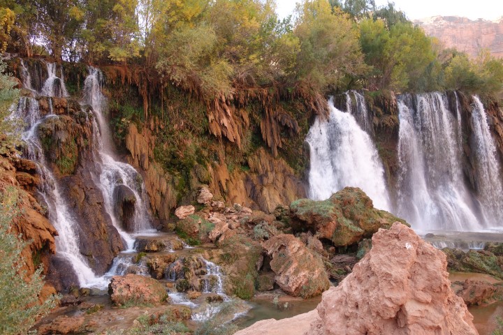
The first set of waterfalls was soon after the village. In fact, we went right by Fifty Foot Falls without seeing them until we turned around and looked back. It didn’t look like we could get near them, or Little Navajo Falls or Old Navajo Falls, but we decided to try in the morning on our way out. At the moment, lunch was imminent and we wanted to make it to Havasu Falls for it.
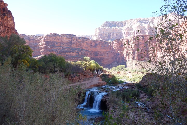
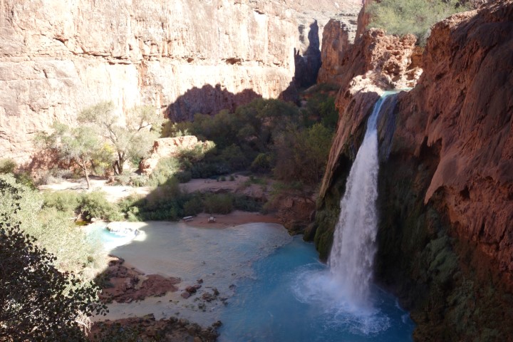
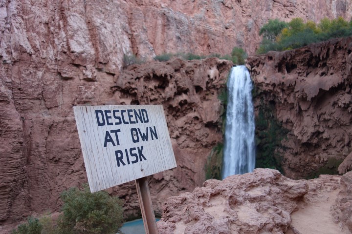
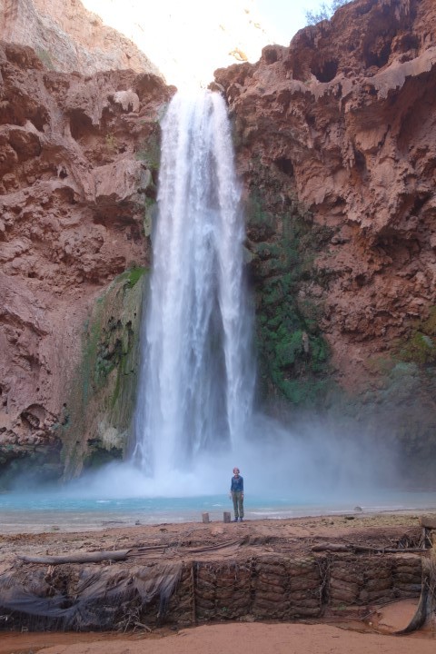
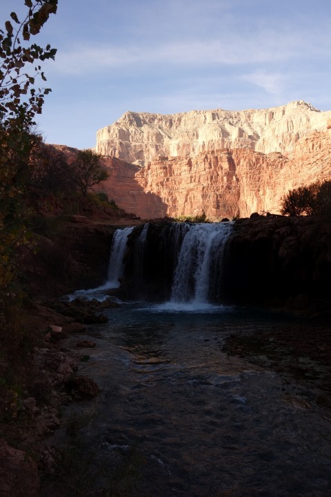
The signature falls soon came into view and it was gorgeous. The water is a very clear blue-green color, owing to its high concentration of lime. We made our way down to the base of the falls to sit at a picnic table and eat. We weren’t that close to where the water was hitting but it was hitting so hard from its almost 100′ drop that the mist was still reaching our picnic table.
After exploring the area a little bit, we went the small distance farther to the campground which was two miles past the village at an elevation of 2750′. It had a very open setup, with picnic tables all over, occasional composting privies, and Fern Spring as the water source. They test it all the time so filtering is not required. We picked a spot and set up camp, then decided to take a quick nap before hiking more since we’d gotten there so early.
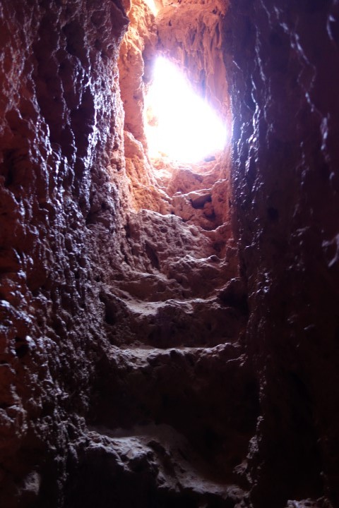
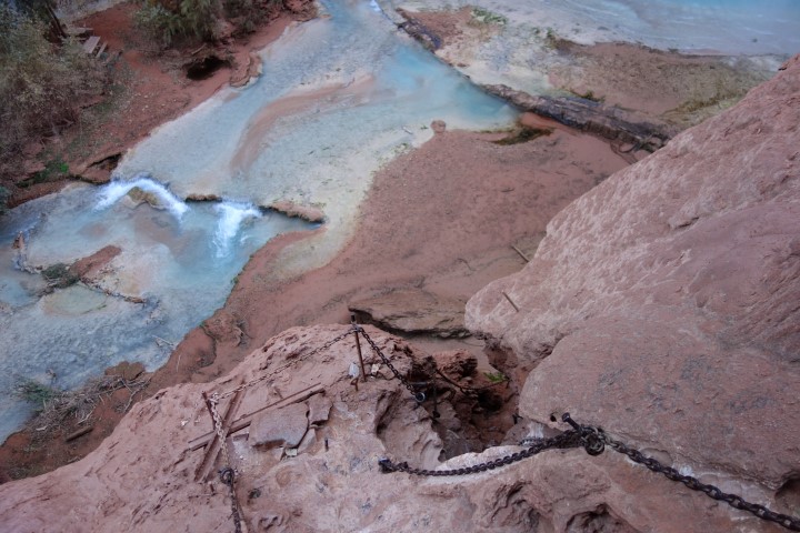
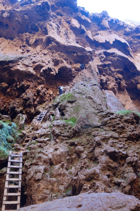
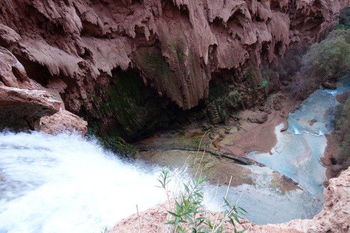
Afterwards, we headed out just past the campground to Mooney Falls, named after a miner who’d fallen to his death there in 1882. Mooney Falls are the highest at 190′ tall. The trail starts near the top of them and goes down the canyon wall very abruptly, through some short caves, and with rebar, chains, and ladders to help people climb down. The trail got very slippery towards the bottom as the mist from the falls was reaching it. It was a fun climb.
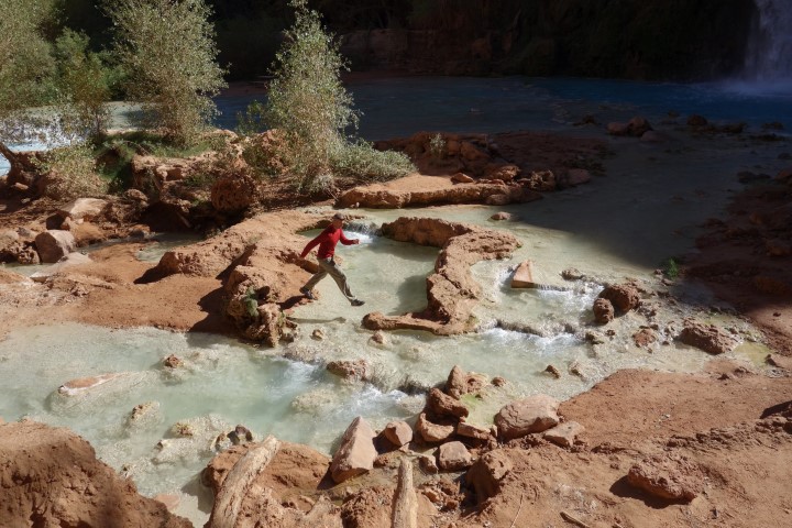
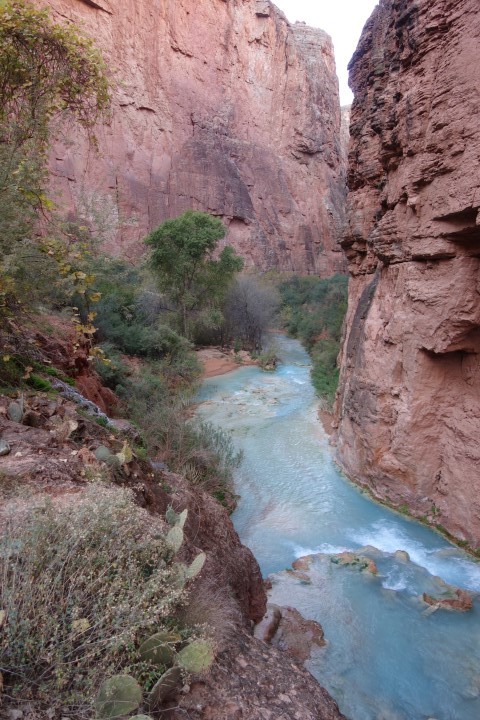
Once at the bottom, we decided to keep going down Havasu Creek, although we wouldn’t be able to make it all the way to the last falls, Beaver Falls, and back before dark. The trail also required crossing the creek several times, and we were not interested in getting our shoes wet the first night out when it was going to be so cold at night. We picked a turnaround time and kept going for a mile or so.
The trail wasn’t in great shape any more. The canyon had flooded during the summer and been closed to tourists for a while, and we could definitely still see the flood damage. Part of the trail would peter out and we’d go back and find another way. We did end up crossing the creek several times since there were logs and boards available. A few long jumps were required.
When it was getting close to time to head back, I wanted to go swimming first so I started looking for a deep spot. The tourist office had mentioned that the water is a constant 68 degrees all year long, and most people come in the summer to be able to go swimming the whole time. It wasn’t that cold at the bottom of the canyon yet, although the water was probably warmer than the air temperature. I like being here in November to avoid the heat and the crowds, but I still wanted to get a swim in. The water felt pretty cold but I soon got used to it. I probably only spent a few minutes in there but it was great.
We headed back up the canyon, climbed up the ladders and chains, and then went and explored the top of Mooney Falls before going back to the campsite. Dinner was done early and it was still light out so we went to check out Havasu Falls again before a very early bedtime.
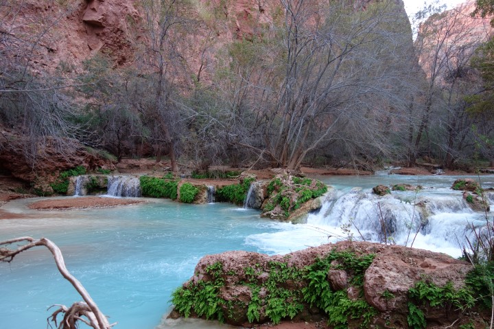
We packed up this morning and headed back out. It was hard to keep going past Havasu Falls but we’d already been there twice and wanted to check out the smaller falls near the village. Once we got closer to Old Navajo Falls, we were able to see a route down that would take us past the base of Little Navajo Falls and Fifty Foot Falls, so we went that way. Fifty Foot Falls had a great swimming hole beneath it and may have been my favorite. I wish we’d have been able to spend more time there.
By the time we made it back through the village, the sun was in the canyon and it was hot. I can’t image being here in the summer. Partway through the hike, we stopped to eat and hydrate in a tiny spot of shade against the canyon wall. Lots of mule trains were passing us this morning, including while we were on the switchbacks heading up to the parking lot. We made it up without incident at ten miles for the day.
This was an absolutely beautiful hike and I would do it again. Next time, I would go a little earlier in the season to have warmer weather for swimming, and I would spend two or three nights in the canyon to able to enjoy it more, and do a day hike from the campground to the Colorado River and back, about sixteen miles.
Oooh, this brought back great memories! Glad you enjoyed it and thanks for sharing!
Justin & I got engaged there in 2005 and have been there several times before that, but not since the big flood that washed out and changed Navajo Falls. I would like to see the changes. We always went for 2 nights in July, hiking at night to avoid the heat and playing during the day. We would always reserve a day to hike out to Beaver Falls and almost make it to the Colorado (although we never did).