I think the rain stopped before I went to sleep my last night in Baxter but it was a loud night with the brook and the wind. The brook provided constant white noise, but it would get louder as the wind swept through. I could only tell it was the wind because I could see the tops of the trees moving around in the dim light.
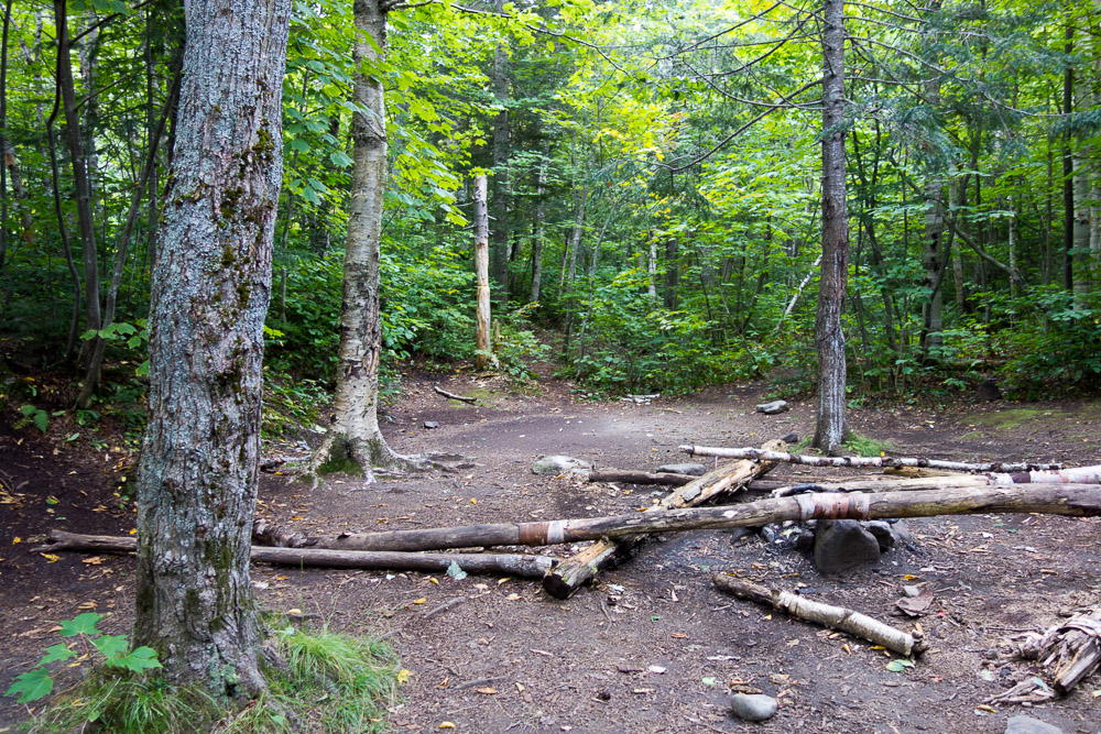
I got up early and packed everything into my car and started driving out of the park. There was a McDonald’s in Millinocket that I was headed towards. First order of business: get rid of my garbage. Baxter is a carry in, carry out facility and they have no trash cans. You also need to keep the garbage in your car due to bears. So my car has been smelling like a wonderful combination of feet, sweaty performance-wear, and garbage. But now I could get rid of one of those smells! Then I headed inside for breakfast, wifi, charging, and a flushing toilet. Heaven.
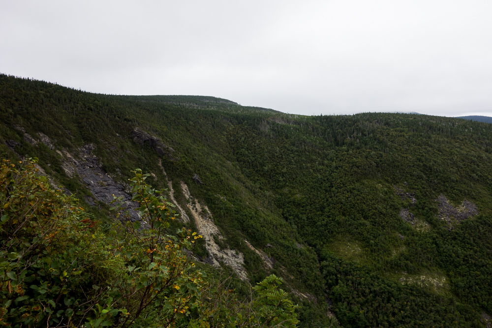
After looking up some updated weather forecasts and details on my next hikes, I hit the road for Carrabassett Valley. The plan was to hike Mount Abraham that afternoon. The forecast showed a 30% chance of thunderstorms that evening, but by the time I got closer (4-hour drive), it was also using words like “severe” and “hail.” I could see the mountains as I drove up and they were enveloped in a huge dark cloud. Hmm…
I pulled over in the town of Kingfield and did a quick search for hotels nearby. I figured I could still do the hike before the storm, but honestly, it was way too hot and humid out too. I really wanted a shower and air conditioning. And it’s my vacation! So I booked a room at the Herbert Grand Hotel.
Right before I walked in, a guy sitting outside told me it was freaky in there, “those people never see the light” or some such. The front desk person was out so I had to wait until she arrived back at 2:00 to get into my room. The place did have a vibe similar to “The Shining.” Or it looked like I was in a game of Clue. The weird ambiance was mainly because I was the only person there. Whatever, I’d paid already and I wanted my a/c and shower. When the front desk person arrived back, she gave me my key and I ran up to my room to turn on the air and jump right in the shower. I also found out there were a handful of other people staying there that night so it really wasn’t that freaky after all.
I did some catching up on the internet, made some phone calls, and then headed across the street to dinner at Longfellow’s. The forecast had changed to a “severe thunderstorm warning” so I felt validated in not hiking that day. While eating dinner, a massive storm with lots of lightning did roll in. Validated again. I went back to the hotel and struggled not to fall asleep too early.
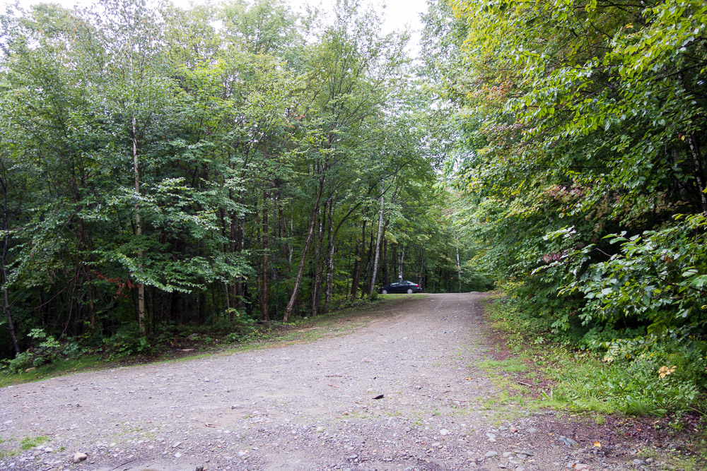
This morning, I awoke early, of course, and quickly grabbed all my things to head out. The Mount Abraham Fire Warden’s Trailhead wasn’t too far out of town, but it was on a road that Google Maps didn’t acknowledge was connected to anything else. I found the right spot by seeing the road continue on satellite view and comparing it to a map from 4000footers.com.
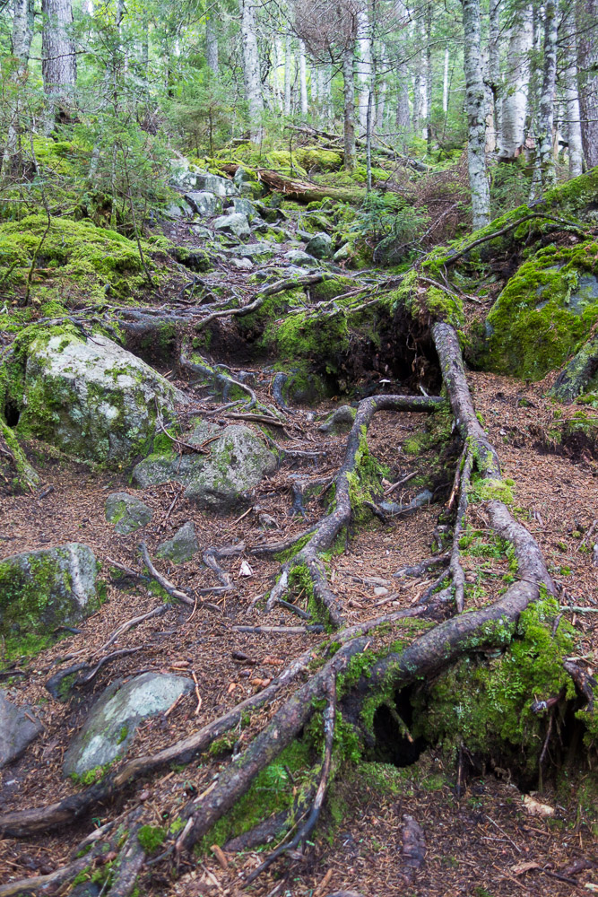
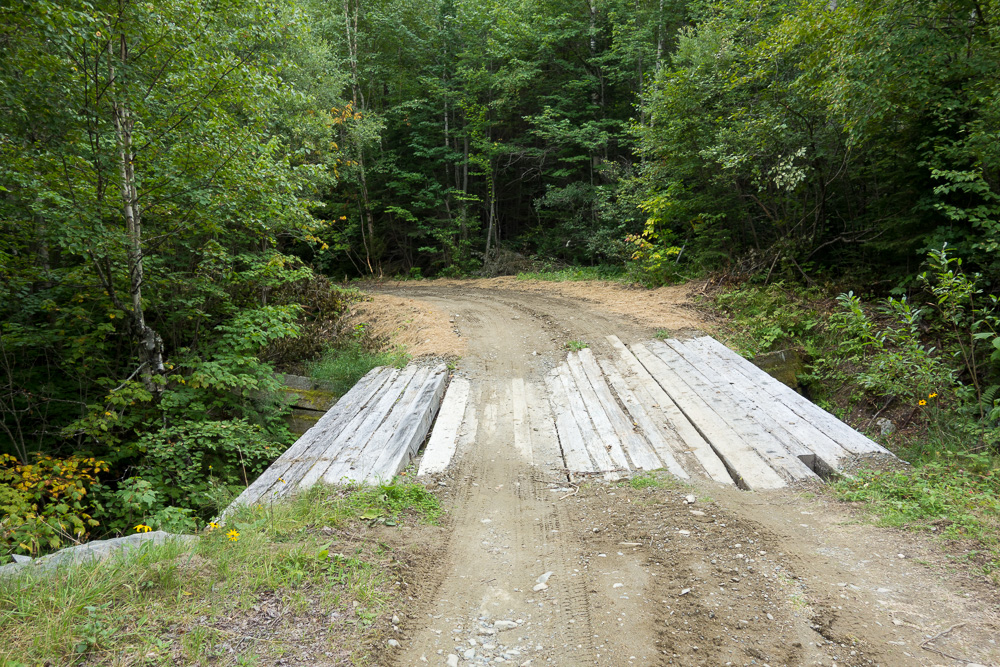
There were varying reports about the road, but since I know the trail adopter for the Fire Warden’s Trail, I just checked with him. It sounded fine, even for my Corolla. I had no clearance issues whatsoever, and only had to really slow down a couple of times. No excessively huge rocks, ruts, or potholes. From Rapid Stream Road, eventually, you make a left to go over a couple of bridges that were replaced in 2015 after a wash-out, make a right after the bridge, and then when the road comes to a T, stop. The trail leads out just to the right, and the parking area is off to the left.
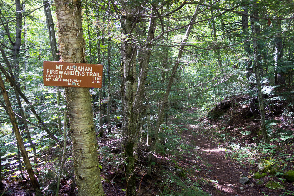
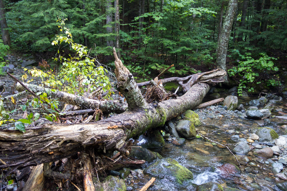
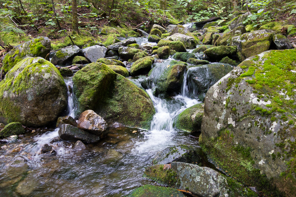
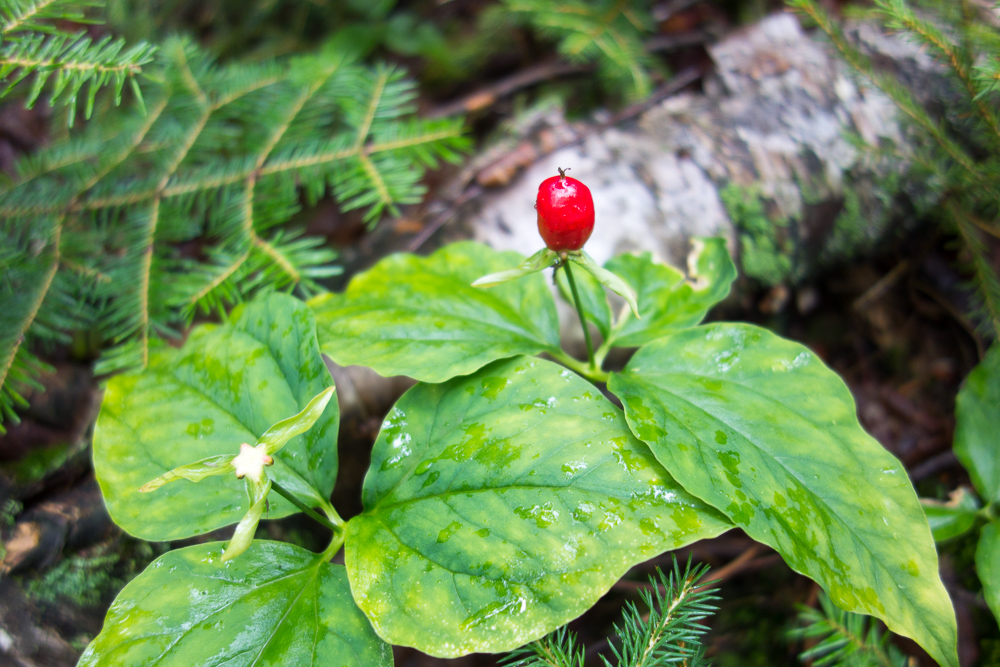
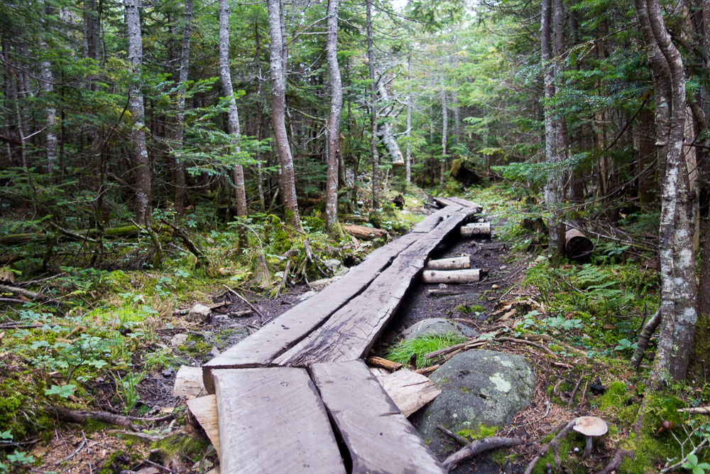
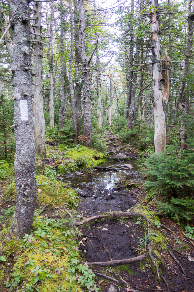
The Fire Warden’s Trail started out with a nice, easy grade for a couple of miles. There were a few small creek crossings and a few large ones, but they were all rock-hoppable. My main issue was that I kept collecting spider webs. The trail clearly doesn’t get used much and I was trailing webs and trying to pull them off of me constantly. I even tried hiking holding a trekking pole aloft in front of me for a while, but that got old quick. I collected enough webs that I kept thinking about all the spiders that might possibly be crawling on me after I took out their homes.
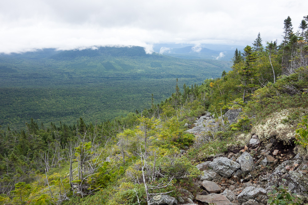
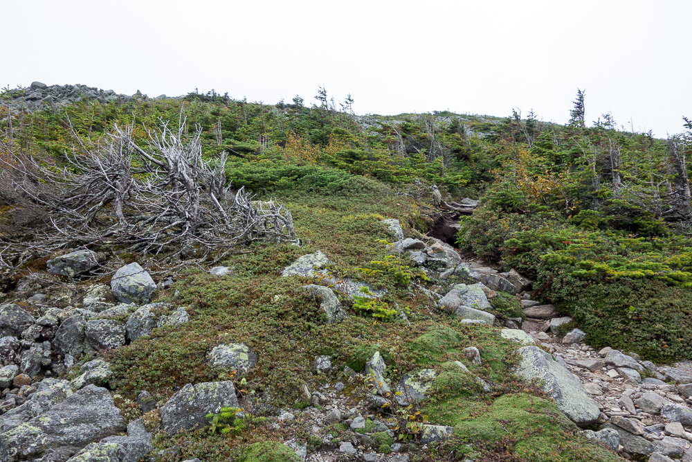
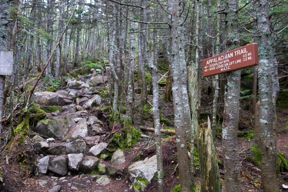
After passing the MATC campsite halfway up, the trail started to get steep. It eventually popped out onto a rock field, where there was an inexplicable sign reading “Appalachian Trail” on its top. The AT is at least two miles away from this sign.
I thought I was above treeline now and the summit would appear above me at any moment, but there were so many false summits! The trail wove in and out of rocky slope and trail through short trees. I finally saw a sign amongst the rocks and knew I was approaching the summit.

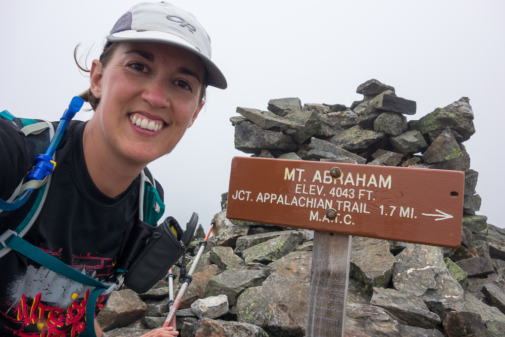
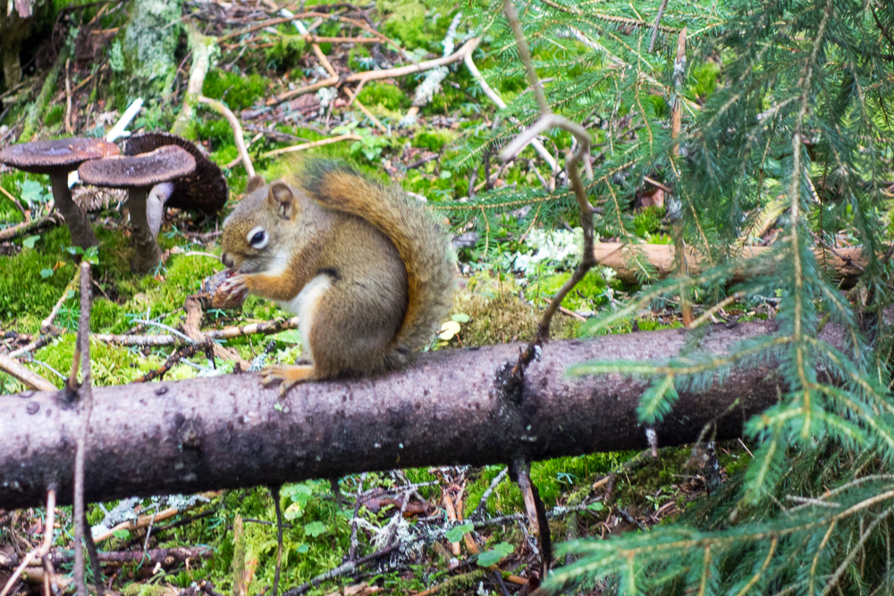
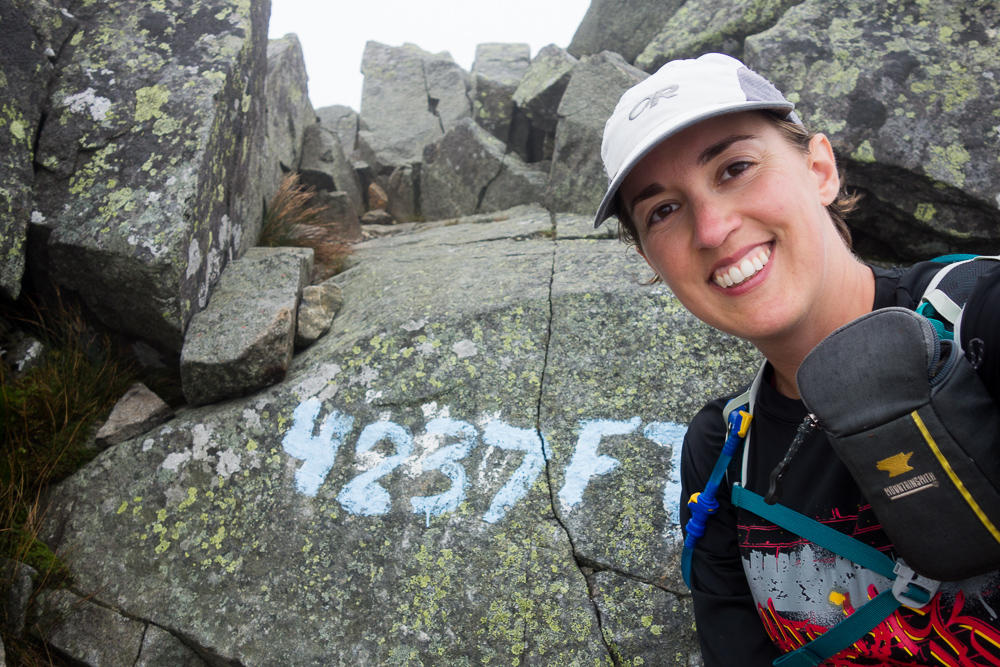
Right as I got to the Mount Abraham summit sign at 4050′, a squirrel started running away from me and I thought it looked kind of weird. Then it started leaping between rocks and I saw it was a flying squirrel! Sadly, no photo, but it was super cool.
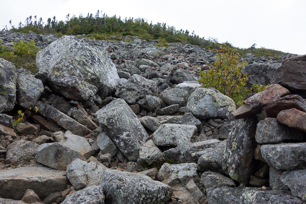
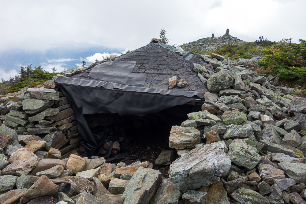
There were the remains of a small tower at the summit, a small rock shelter which seemed to have the old tower’s roof on it, and some really large cairns going off in the direction there wasn’t supposed to be a trail. I went to investigate and they looked to keep going. I saw later that it’s the South Side Trail, one not on maps but used by locals.
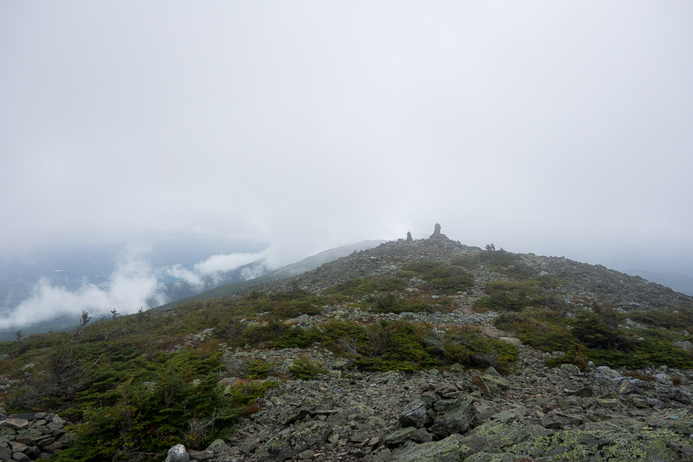

The summit was in the clouds and windy and chilly to boot so I didn’t stay long, but decided to hike back to treeline before having my snack. After a short break, I continued down the trail, this time stopping to check out the campsite.

I would have thought I’d collected every spider web on the way up the trail, but there were still a few large ones I found with my face on the way down. Lovely.
I made it out to the car in good time after my 8-mile hike but I noticed that my rear driver’s side tire looked low. I had just refilled it a couple of days ago and already suspected a slow leak. Apparently, the rocky road had jiggled things around enough that it was a faster leak now. I had enough pressure to make it back to town and went to the closest mechanic. He didn’t have time to look at it, so I called another nearby one, and he didn’t have time either. I could see the next closest one was nearby the next trailhead I wanted to go to, so I pulled into a gas station, refilled the tire, and headed for Mountainside Garage in Carrabassett Valley. A truck was just coming out of one bay so they took my car right in and found a nail in the tire. I knew it! A quick and convenient fix later, I drove to the Caibou Pond Road trailhead.
I’d also read conflicting reviews of Caribou Pond Road, although nothing as bad as Rapid Stream Road. But I found it to be the worse of the two. There were several uncovered culverts that it seemed like people shouldn’t be driving over. I made it to a gate in the road, apparently a half mile before the trail. It was easy walking but added a mile to my 5.8-mile hike. There were some sketchy bridges in that closed half mile of road before the trail so it makes sense that it’s closed.
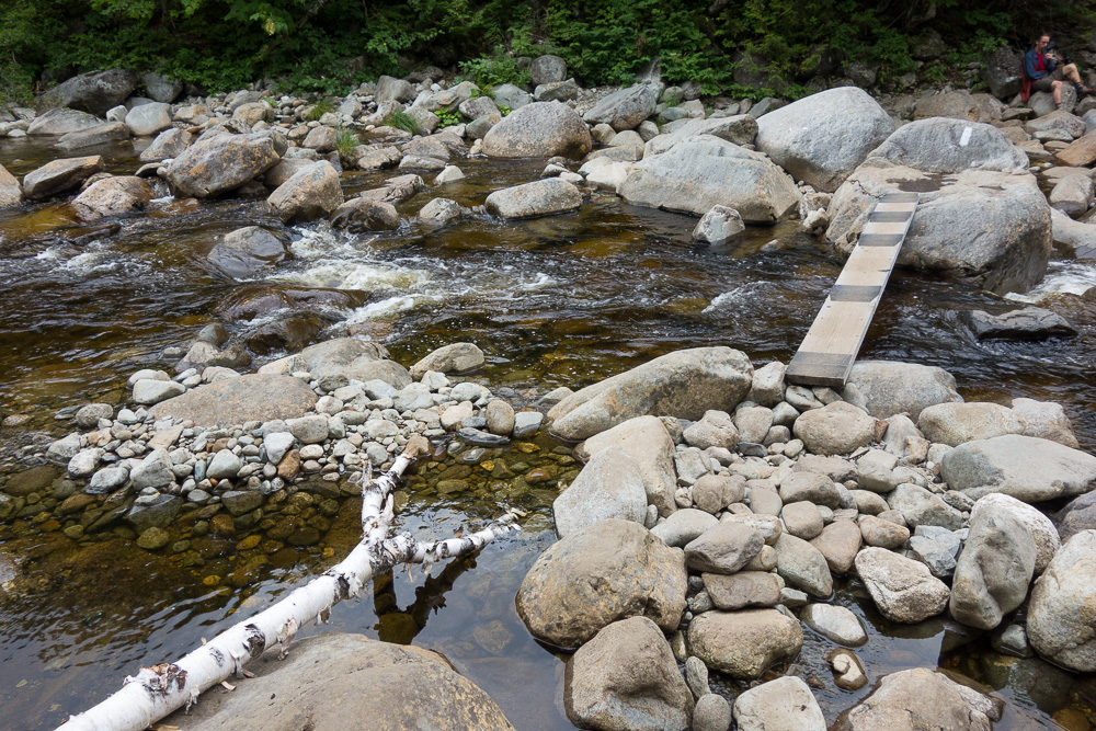
I took the Appalachian Trail south from the road and immediately came upon a nice, big campsite that I considered camping at tonight. It would depend on how many thru hikers showed up. I crossed the South Branch of the Carrabassett River and the board to help in the crossing looked a lot more stable than the one that I remember being here 5 years ago.
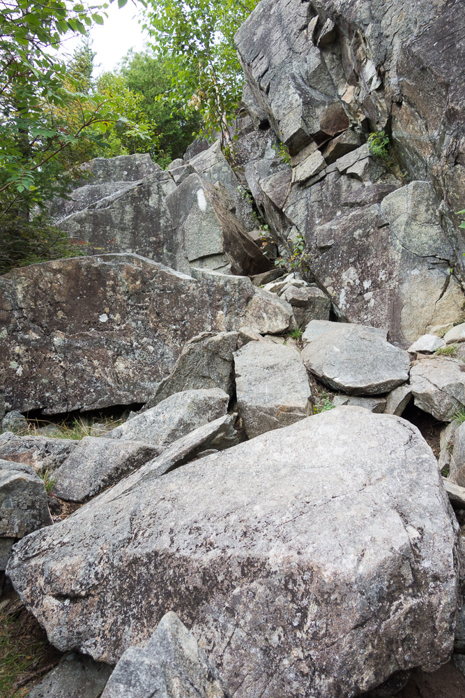
The trail was immediately really steep and incredibly rocky. I knew there was a ski trail also going up Sugarloaf Mountain, but I figured even though it was shorter, it would be uncomfortably steep and rougher walking than a hiking trail so I’d make better time on the AT. I was soon reminded that the AT in Maine is also often uncomfortably steep and rougher walking than a hiking trail should be.
The trail did eventually get up to a point where I could start traversing across the mountain and only climb a little bit along the way. It was super rooty and muddy but I still made great time to the side trail to the summit.
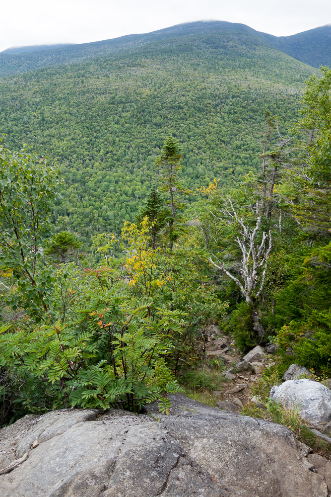


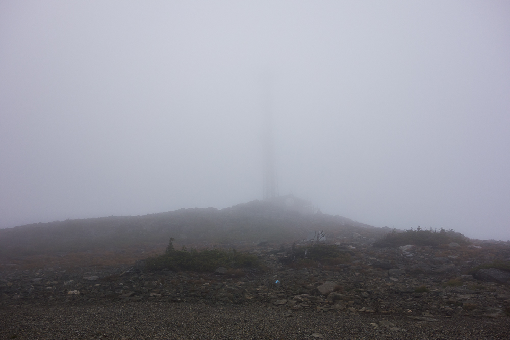
As I climbed higher, I started to move through the mist like raindrops hanging in the air. I came out of the trees into a cloud just before the summit of Sugarloaf Mountain at 4250′. It was very windy and chilly but I sat behind some rocks, partially protected from the wind, to have a snack before heading back down.


I made it back down the mountain quickly. There were only a couple of hikers in the campsite near the road but I still decided to sleep in my car, mainly out of laziness in avoiding walking back up and down the road multiples times. I managed to cook dinner, clean myself up, and rearrange things in my car before dark. Just as I was settling in to eat, another car pulled in and went through the same bedtime prep. I guess it’s good to have neighbors.
Kris, I love to read your adventures! The great narrative is joined by awesome pictures!
Love. Aunt Nancy