I slept wonderfully and woke up to read for a little bit in the early morning. I could hear the loons on the pond again all morning.

After eating breakfast, I went up to the bathhouse to see if any of my laundered clothes were dry. Some of them were dry-ish but luckily there was a hand dryer to finish them off with! We all took our time getting ready, paid the iron ranger for the night, and got ready to leave. Right as we had our packs on, a guy pulled up in a car and popped out to ask if we were Cohos hikers. He was section hiking the trail and had driven two and a half hours to day hike a couple miles south of the park and back. We gave him some info on the logged area in case he decided to go that far, then said goodbye and started walking.
It was going to be a long road walking day and we started by taking the paved road out of the park. We stopped at the park office a quarter mile down the road for coffee, and Chuckles won a trivia question for some free candy. We finally started moving again, down the paved Diamond Pond Road and then turning off onto the gravel Heath Road. That eventually turned into Bear Rock Road and it switched back and forth between paved and gravel. It was a beautiful walk though. We walked quickly and listened to a couple of podcasts to pass the time.

Towards the end of the road, a big red truck pulled over to say hi to us. The guy driving knew all about the Cohos Trail and loves seeing hikers. He had a puppy named Maggie for Magalloway, one of the nearby mountains, in the backseat and she just loved on Chuckles, also really named Maggie.

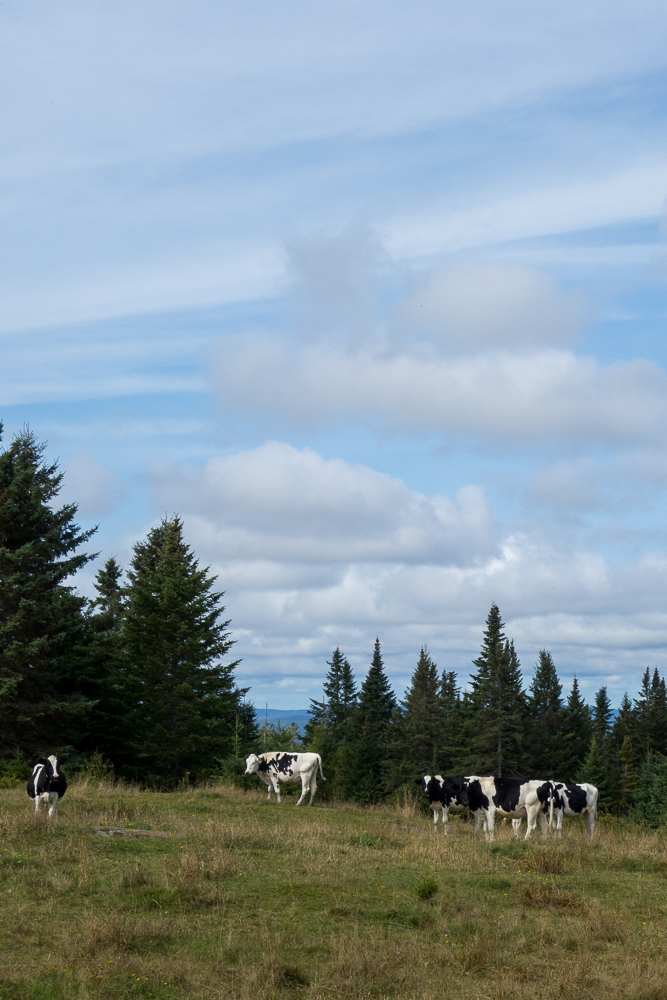
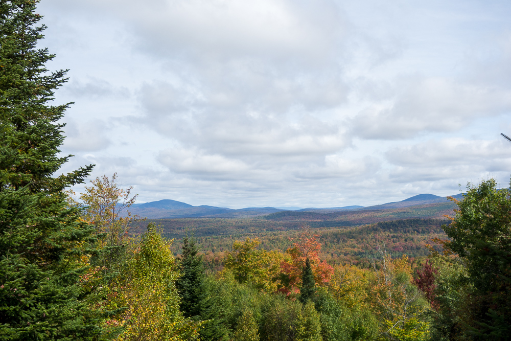
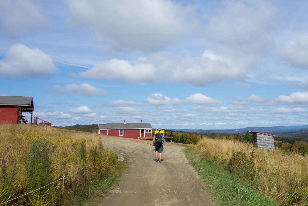
After saying goodbye, we turned onto the gravel McAllaster Road and started walking uphill through farmland. The higher we got, the better the views were along the way.

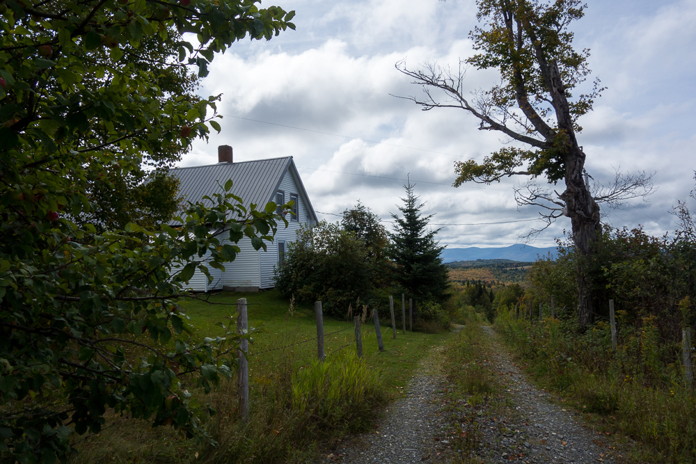
We passed a house labeled as an “abandoned homestead” in our databook but it looked really nice and well-kept to me and even had an electric fence running. If it is abandoned, I want it. There was an apple tree on the road soon after with more delicious apples.
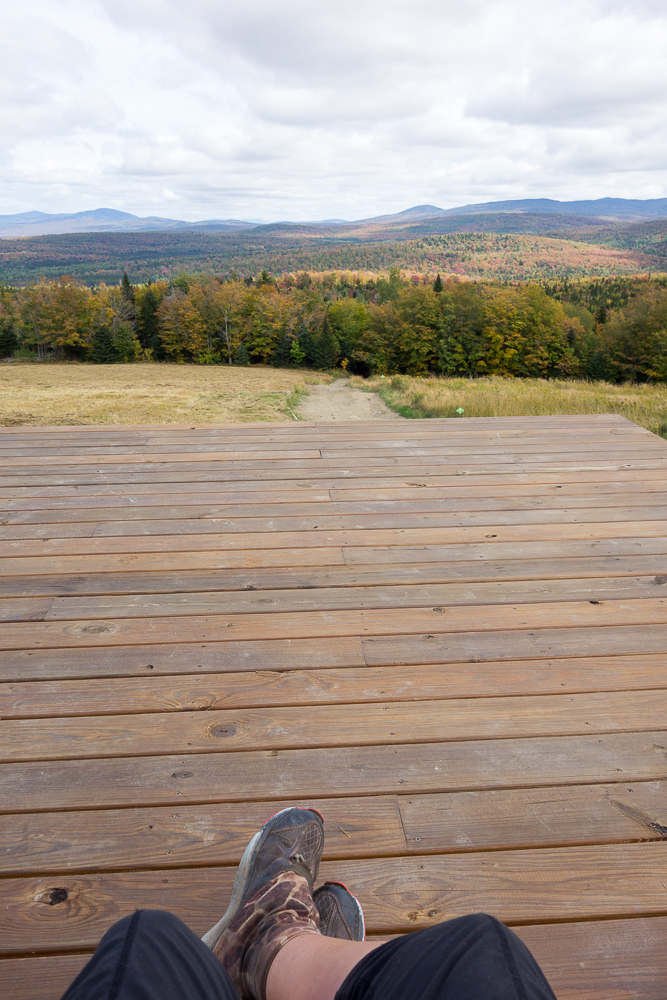
The road turned into Haynes Road, then Weir Road. We were passing a lot of rental cabins and talking about how wonderful it would be if someone invited us to sit on their deck or at their picnic table to eat lunch. Just then, we came across a truck blocking the one lane road. It was Mr. Weir, of the old tree farm we knew we’d be passing through soon. We stopped to chat and he invited us to sit on the deck of his cabin for lunch when we got there since it has panoramic views. We gleefully accepted. Trail magic!
When we got to the cabin, there was also a skimobile snack shack there, with a picnic table in the shade. We ate there, then moved over to the cabin’s beautiful porch to enjoy the view for a while. It was a long day but we were making great time so we could prolong the break some.
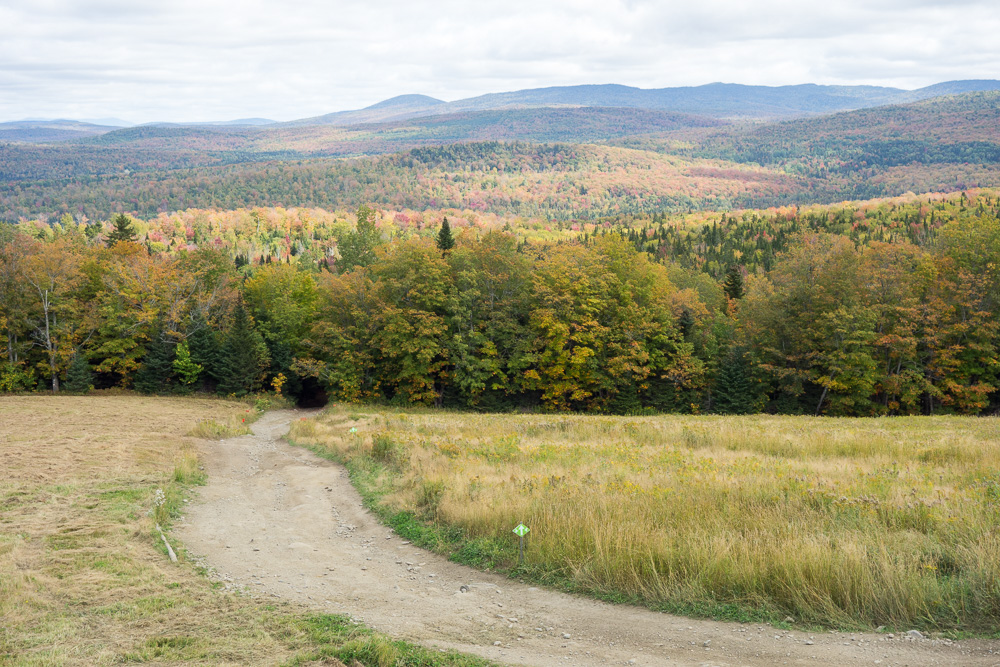

We finally had to get moving though and continued walking down the dirt road to what we thought was our only trail for the day. The Deadwater Trail turned out to be an ATV trail that still looked like a road so it turned out we were road walking the entire day.
It brought us out to Deadwater Loop Road where a few ATVs passed us. Most of the way down the road there was a kiosk, picnic table, and privy not mentioned in the databook. We stopped but it was too hot in the sun to stay long.
We turned up Cedar Stream Road which we thought would be a lakeside walk along the south shore of Lake Francis. Turned out that the road was not right next to the lake and there was some heavy woods between the two so we only got one glimpse of the lake at the beginning of the road walk.
A woman in a Ural sidecar motorcycle stopped to talk to us, which is really awesome as I always wanted one of those. I would love to hitch somewhere in a sidecar too but this road was part of the trail.
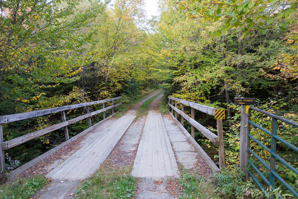
It’s a good thing we were making good time because we had thought we might be able to find camping along the lake since it was flatter, but it was all private properties. It’s marked as federal/state land on the map so I’m not sure how that works. We did finally make it to the end of the lake and turned off onto the Lake Francis Trail. We crossed a bridge and it looked pretty flat but before we got to the next bridge, we came across a cabin with a truck blocking the trail and at least a dozen hunting dogs tied up. So much for camping right past the trailhead.
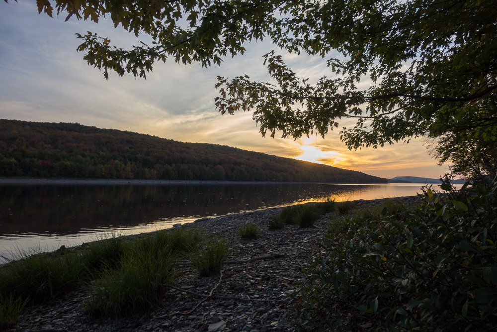
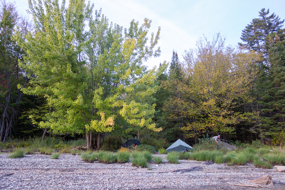
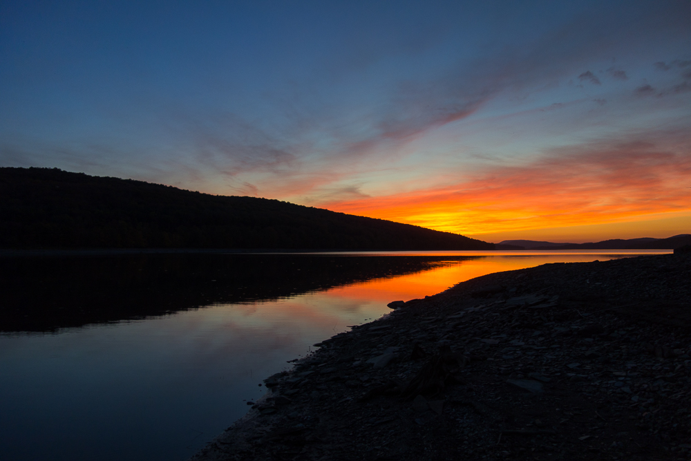
The guy sitting there told us that if we kept walking for ten minutes, we’d see a trail down to the lake and people camp there sometimes. We took him at his word and were able to find the trail. The lake shore was very rocky but we did find a flat-ish spot on smaller rocks to clear a few tent spaces. We got there just in time to eat dinner before sunset. 19.5 miles for the day.
“We gave him some info on the logged area in case he decided to go that far.” Could you share some of that info with me, so the logged area won’t slow us up as much? A general compass direction to find the continuing trail in the woods? Or any other directional suggestions? There will be just two of us, with a dog, hiking fairly slowly and cutting down on the guesswork at that spot would be really helpful. Thanks.
Hi Bob. I don’t recall a direction at this point. If you have two people it will be easier to find the trail – one person can stick with a known blaze while the other person goes off and looks for the next one. We didn’t get lost exactly in this area, it just took us a while to get through as the blazes can be hard to find. That could change by the time you go through.